

[ad_1]
This week has been a little bit challenging weather wise. It’s been cold, misty and windy. The trail has also been very diverse in terms of scenery and terrain. We reached and passed the 100 miles mark so all the miles after I hadn’t seen before.

We made it to 100 miles on a misty day.
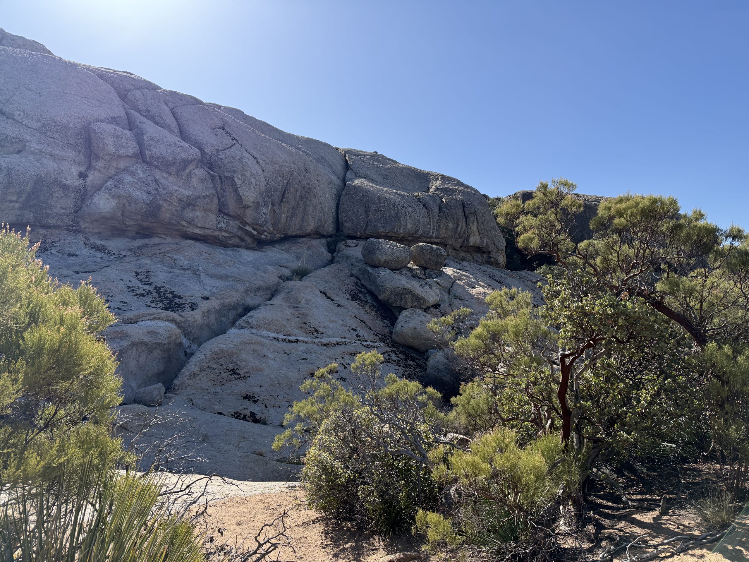
After passing the 100 miles mark we hiked through an area of rolling hills and cows. There in the middle of it was Eagle Rock, such a stark contrast with its surroundings.

Valley with cows

Eagle Rock
A nice rest stop after the 100 miles was the Warner Springs Resource Center. This is a popular stop for hikers for good reason. They have hot food, coffee, showers, wifi, a little store that sells anything you would need to resupply including first aid kit things. You can’t camp there but there is a campsite close enough that you could hit the center for lunch and for breakfast the next day if you time it right. The people that run it are also very knowledgeable of the area ahead. They have a cool map where hikers put a pin where they are from and we were the first pin in Puerto Rico 🙂

First pin in Puerto Rico! 🇵🇷

Campsite near the Resource Center
The next day was a long day. We started out in Warner Springs Community Resource Center and set out to make it to Mikes Place, 18 miles away and almost 3k in elevation gain. Water was plentiful until about 6 miles in, so we had to carry the water needed for the last 12 miles. The day was cold, windy and cloudy. At night we all packed our tents behind Mikes Place house to try to avoid the wind.
I had this idea in my mind that Mike’s Place was a quirky whimsical spot to hang kinda like a hostel where you could camp on the patio or a campground with amenities. In reality it was a house surrounded with junk all over the patio. I’m not sure if it’s operational or if we all camped illegally on private property but after a hard day we were all too tired to keep going.

All huddled up. Wind chill was 21 degrees.
Our next highlight on trail was the famous Paradise Valley Cafe. Also a popular stop for hikers as it’s only a mile from trail and also you can send yourself a resupply box there. We got there in time for lunch and had burgers.

Hiker resupply boxes.
We stayed there hanging out with other hikers for a few hours. Based on comments on Far Out, you can camp there but the area that we could camp was the back parking area that was open and too close to the road. We decided to keep going a few miles and spent the night in a beautiful boulder field.

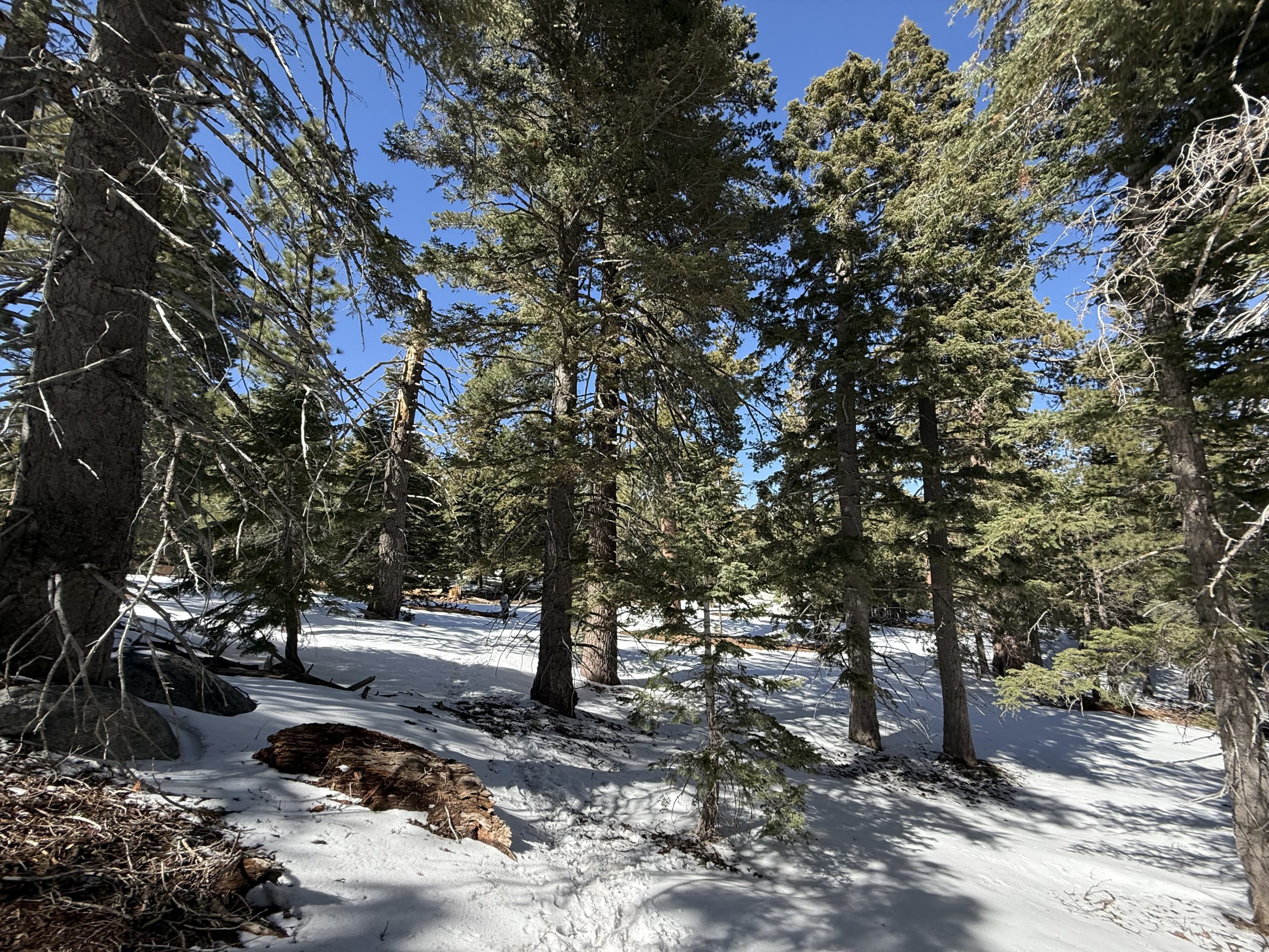
The next two days after this had a lot of elevation gain as we are hiking into the San Jacinto area, which is above 8,000 ft in elevation.

The last day before we headed to Idyllwild, we reached the snow. This was slow going not only because of the snow but also blow downs long the trail. It’s amazing how you go from cactuses to a winter wonderland in a few days.
On our 14th day we made it to Idyllwild where we would rest for a couple of days. We had some good food, met the mayor Max and ran into some of our friends that we haven’t seen in a few days.

Idyllwild town monument

Breakfast!

Mayor Max (the dog with the tie)
Now to get some rest and get ready for week 3.
This website contains affiliate links, which means The Trek may receive a percentage of any product or service you purchase using the links in the articles or advertisements. The buyer pays the same price as they would otherwise, and your purchase helps to support The Trek’s ongoing goal to serve you quality backpacking advice and information. Thanks for your support!
To learn more, please visit the About This Site page.
[ad_2]
Source link


