

[ad_1]
Day 10: Dick’s Creek to Plum Orchard Shelter
Catch a Ride!
I tend to struggle with sleeping in bed after years of sleeping in a hammock. I woke tired and unrested from the stay at the Holiday Inn but was eager to hit the trail.
My hiking companion, Mitchell, didn’t have a chance to hit the laundromat the day before. So we stopped by before the shuttle at 1pm.
While waiting at the laundromat, a lady began talking to us about the trail. She had attempted last year, but around mile 98, she experienced a stress fracture and had to get off trail. She plans to start again later in the week.
When the laundry was done, she offered to give us a ride back to the trail. We eagerly accepted, hitched a ride in her RV back to Dick’s Creek, and set out again!

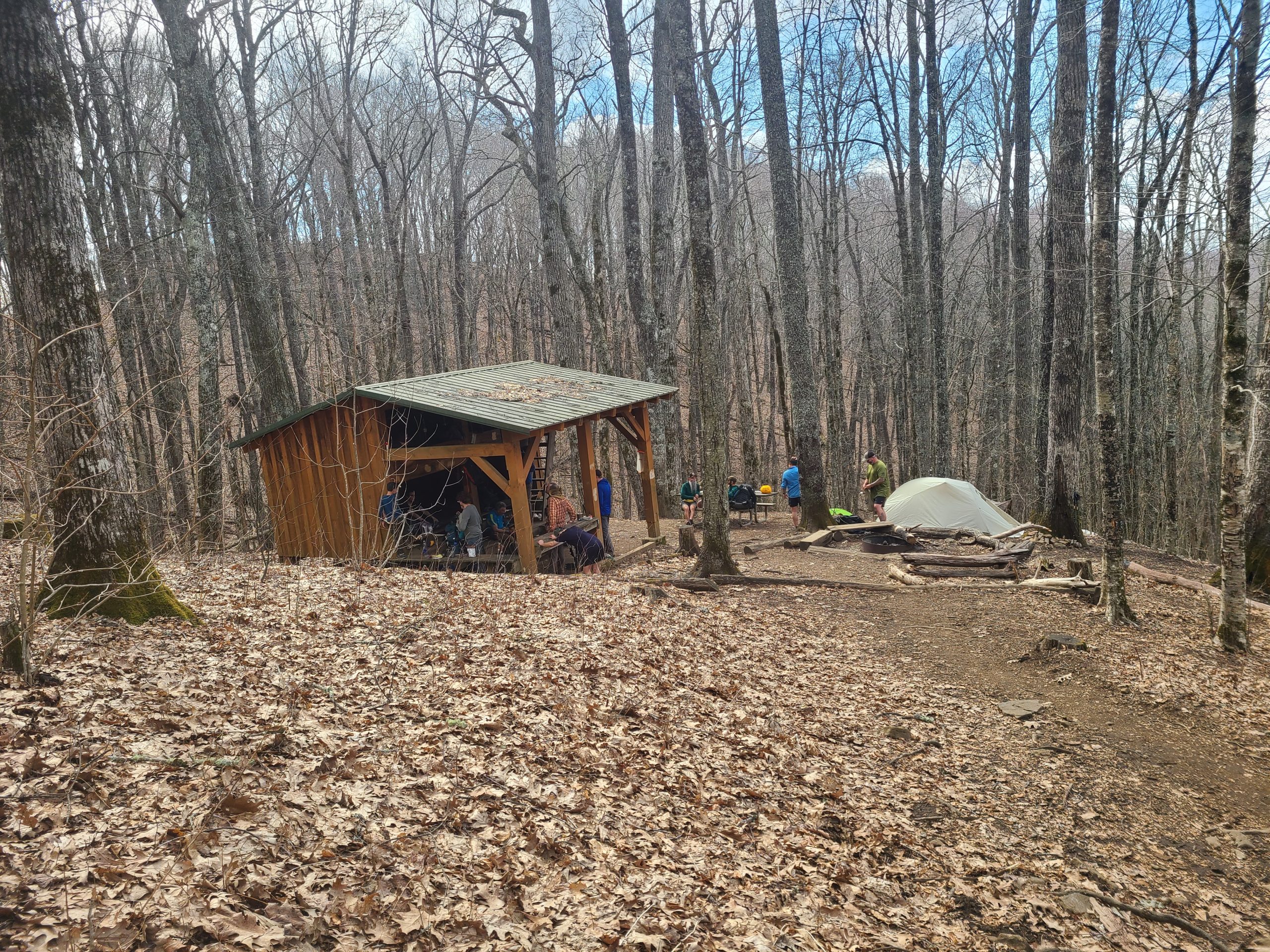
Back on Trail!
We hiked a short day to Plum Orchard Shelter and settled in with a small group that was there: a Polish Thru-Hiker named Kermit, as well as two brothers who were section hiking.
I went to bed early in anticipation of the big day ahead of us.
Day 11: Plum Orchard Shelter to Muskrat Creek Shelter
Uphill the Whole Way
My hiking companion wasn’t feeling well and was still in camp whenever I left, but we had agreed to meet at Muskrat later in the day.
We had to ascend 2,858 ft in 7.5 miles on this day. We also descended 1,299 ft but it was barely noticeable in comparison.
Fortunately, there was some nice rain, fog, and wind to accompany our grueling climb on this day. Sadly, this meant my phone had to live in my pack most of the dayweek and so I wasn’t able to get a bunch of relevant pictures.
The rain wasn’t too bad in the morning but was predicted to pick up around noon. I decided to forgo my rain gear and deal with the light rain. Previously, I had found that I would be drenched with sweat when I would wear the gear; so I didn’t feel the juice was worth the squeeze.
Farewell Georgia, Hello North Carolina
Today was a big milestone as it marked my completion of the first of the fourteen states I will be crossing through on this journey.
There was actually a large gnarled tree further up the trail that marks the official state line, but they didn’t put the sign on that tree for some reason, and I didn’t get a picture with it.
As soon as I crossed into North Carolina, the wind and rain started to pick up.

Desperate Battle
After crossing that Gnarled Tree, the elevation quickly escalated up to a point known as Sharp Top.
I had barely started this climb when the wind, rain, and lowering temperatures convinced me I needed my rain gear now. As the RV lady had told me the day before, “It is better to be hot and wet, than cold and wet.”
I pulled out my rain poncho and had the fight of my life trying to get it on in the rain. The bottom kept blowing over my head when I had it halfway on and I’d have to start over. I put my head through the ‘sleeve’ in the chaos and had to back out and start again.
Once I finally got my head through a hole and still couldn’t see. Once I pulled it back out, I realized I had found the head hole, but it had turned around, and the hood was in my face.
I must have looked like a blue flag of desperation, standing on the side of that mountain struggling with the poncho, but eventually, I did prevail.
Harrowing Ascent
I sat for a moment to catch my breath, and with the poncho blocking the wind, I was able to warm up a bit.
Knowing I couldn’t sit forever I got up and grabbed my pack. The wind kept blowing back my hood so I sinched it down like I was Kenny from South Park and started to climb.
My glasses were covered in rain on one side and fog on the other. The hood being so tight limited my range of vision. The fog in the air, mixed with my own near-sightedness prevented me from seeing much of anything. 
I kept my eyes on the ground and followed what I hoped was the trail. All of it looked like slick rock and mud at this point.
I felt myself growing exhausted with the climb, the energy from breakfast having been spent on the climb to get this far already. I couldn’t tell how far I had climbed nor how far I had left to go. Instead I focused on putting one foot in front of the other.
Looking up, my eyes were in the hood of the poncho, and I said a silent curse at the situation. Actually, I vehemently and loudly cussed but it was lost to the wind.
In truth, I was becoming concerned. There was a word I knew the definition of, but was starting to actually understand it: Exposure. I wanted to rest, but knew it wasn’t even noon yet, and things were scheduled to get worse.

The Trail Will Provide
I managed to yank my hood up enough to see a patch of green above me and pushed on towards it.
Once I arrived, the wind stopped its assault, and I was relatively dry once I reached this green blur above me.
Rhododendron.
I’ve always known I would like this plant from the moment that I first heard its pretentiously long name in the song King Bettle on a Coconut Estate by the band mewithoutYou when I was in high school. Now I felt indebted to the plant.
Between the slope of the land and the canopy of rhododendron created a sanctuary from the elements. I rested here, ate lunch, and warmed up.
I could hear the wind blowing around me and could hear the rain, but felt safe in its green embrace.

This is an example of the Rhododendron.
Arriving at the Shelter
Finally, I pushed on to Muskrat Shelter. The trail followed a path alongside the mountain opposite the wind, so the day was much better moving forward, albeit still cold as I was drenched.
I got to the shelter and sat trying to warm up. I was rather miffed whenever an Englishman named Ninja arrived in shorts and a t-shirt talking about how ‘Bloody warm a day it is.”
Checking my phone I saw that my companion had messaged me and said he was getting off trail for a few days due to illness. My other hiking companion, Mark, had pushed ahead. I was back in a sea of strangers.
Day 12: Muskrat Creek Shelter to Carter Gap Shelter
This was a longer day 12 or so miles. It was still foggy, and there was a lot of moisture in the air as it seemed we were in the clouds.
We pushed on past Standing Indian Mountain, which marked our highest elevation yet, sadly, there were no views as everything was coated in a sea of fog. I kept looking into the fog expecting to see a shadowy figure stalking us, but I never did.
I ended up hiking with a couple of guys for most of the day which made the miles fly by. We arrived at Carter Gap, where I reunited with Mark.

Day 13: Carter Gap Shelter to Long Branch Shelter
Not Too Bad
I’ve enjoyed North Carolina with its relatively flat terrain and abundance of switchbacks making it much more pleasant than the steep climbs we experienced in Georgia.

So far there have only been two exceptions to this. Sharp Top where I struggled with my poncho, and Albert Mountain.
Pretty bad: Albert Mountain
We crossed Albert Mountain on this day. It is significant because the final climb is exceptionally steep, but more importantly, it marks the 100-mile point of the Appalachian Trail.

We climbed to the fire tower pictured here.
I arrived and waited for my companion, Mark, as it was a monumental accomplishment that should be shared with a friend.

Mark and I sharing a photo op on Albert Mountain


After enjoying the first fog-free views we have had in days, we pushed on to Long Branch Shelter, which was PACKED! I ended up camping on a hill down the trail with a hiker named Jones and his dog Indie, as well as another thru-hiker named Poppins.
Day 14-15: Long Branch Shelter to Franklin, NC
This was a quick and easy hike. I stopped for some trail magic on the way before arriving at the pickup point for a shuttle to The Grove Hostel where I would be staying the next two nights to wait out an incoming storm.

While here I joined a fellow Show-Me State thru-hiker named Jack. We grabbed some food from a local Mexican Restaurant and went to a local brewery where we met up with several fellow hikers we had met over the last couple of weeks.

It was a great night to catch up and share stories with people we hadn’t seen in days!

For now, we will rest during the storm, but soon, we will continue our journey onwards.
[ad_2]
Source link


