

[ad_1]
We crossed the Delaware River and into New Jersey on the Route 80 bridge. I didn’t realize how much the bridge moves when the trucks go by! We took our photo of the NJ/PA border sign on the bridge, then hurried across to get back to the woods.


After hiking up the NJ side of the Delaware water gap we navigated the rocks around Sunfish Pond.


The pond is really pretty, and I surprised a few Garter snakes in the area as I scrambled across the rocks. The weather was gorgeous that day, sunny with a high of around 70 degrees, and I thoroughly enjoyed it!
We stopped at a tent site for lunch and I was pleasantly surprised to see both a privy and a bear box there. After lunch, some more climbs brought us to a ridge with some great views.

The Mohican Outdoor Center (MOC), which we hiked to that day, is run by the Appalachian Mountain Club, which also owns the huts in the Whites of New Hampshire.

It has a lodge that’s open 24 hours a day as well as a small resupply store and restaurant. The manager, Christine, loves helping people get outdoors and was incredibly friendly and helpful. We ended up staying by ourselves in one of their bunkhouses meant for about a dozen people, even though it was just us!


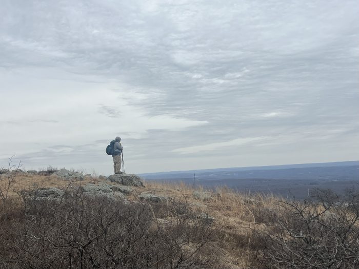
April 3rd brought more great hiking and a change in the weather.
We arranged a shuttle with Misty (she is terrific!) and got dropped off at Crater lake. We then hiked south back to the MOC, where we were staying for another night.

Like our shuttle driver, the day was misty! The dense fog made everything quiet and a little bit eerie.

We enjoyed a lunch of small mixed berry pies that we had picked up from the Village Farmer Bakery back at the Delaware water gap. They were delicious!

I was hoping that the fog would burn off by the time we got to Catfish fire tower, but no such luck. It was still cool to watch the fog blow across the trail.

Hiking the trail along the cliffs on the Kittatinny Ridge gave us really good views shortly before we descended back down to the MOC for the night.

The next day we got dropped off at Crater lake again, although this time we headed north.
It was another foggy day. We passed several more beaver lodges but still didn’t see any beavers. I did find some pretty flowers growing along one of the stone steps on the trail.

Rattlesnake mountain and Blue mountain offered some good views even in the fog, and we ate the last of our pie for lunch near the turnoff for the Brink Road shelter.
Our hike ended down in Culver’s gap with dinner at Smokin’ MOs BBQ…. Yummmmmm! We got a ride over to the Cobmin Ridge motel and took a zero the next day to get some laundry done and avoid a day of rain on trail.
The following day we hiked 11.5 miles from Culver’s gap to the Rutherford shelter.
Sunrise mountain has a pavilion at the top where turkey vultures were soaring within feet of us.


We passed the Mashipacong shelter in the afternoon and talked to a group of college kids from Brown who were out for a backpacking training trip. They offered to share some of their food with us (they had so much it covered the whole picnic table) but we said no thank you as we had just resupplied and our food bags were pretty heavy.
There was another group of college kids from the same group at the Rutherford shelter, where we stayed for the night. They were interesting to talk to and very excited to learn more of the ins and outs of backpacking. One “lesson” we watched while sharing the site was the “hanging a bear bag” lesson… they spent a good hour on it!
Heavy rain was in the forecast for the night, so Bamboo and I set up our tent and let the kids all stay in the shelter instead of under the tarp they would have had to set up.

I discovered an unwelcome attachment when I used the privy that evening, and had to pull a tick off my thigh. After a thorough tick check we both felt relieved that neither of us had any more on us! I did see another tick on the outside of the tent before we went to sleep.
The Rutherford shelter has a bear box, privy, and apparently a resident porcupine!

I loved watching the little guy as he (or she) chewed on the branches of a nearby little tree. The squeaky sounds he made were so cute!
It rained really hard for most of the night, and there was a mix of sleet and rain slapping the rain fly early in the morning.
We waited until the rain stopped before leaving the tent to make breakfast, and it was around 9am by the time we were back on trail.
It was chilly and drizzly all day during our hike from the shelter to somewhere around Unionville, NY.
I learned a lesson that day about paying attention to the details in FarOut.
I had been looking forward to checking out the High Point monument, and had told Bamboo that the views would be great from the top….but I didn’t realize that the AT doesn’t actually take you to the monument! It clearly says on FarOut that there is a 0.2 mile, steep, side trail that goes there, but I didn’t read it!

Only when we started heading downhill below the monument did Bamboo laugh and let me in on the “secret”. Oh well, it was too foggy to see much anyway!
We kept hiking in the rain and mist through old pastures and along some short boardwalks. I thought we’d stay at the “secret shelter” that night but as we got colder and wetter throughout the day we changed the plan.


Jamie, a local shuttle driver, was kind enough to pick us up at the last minute from Unionville Rd and give us a ride to the Appalachian motel, where we stayed that night. I was really happy not to be camping in Unionville that night, as the temperature dropped even more and it started snowing around 7pm.
The cold and rain had me feeling under the weather so our next day was another zero. I took some EmergenC and I’m sure I’ll feel better and ready to go tomorrow!
This website contains affiliate links, which means The Trek may receive a percentage of any product or service you purchase using the links in the articles or advertisements. The buyer pays the same price as they would otherwise, and your purchase helps to support The Trek’s ongoing goal to serve you quality backpacking advice and information. Thanks for your support!
To learn more, please visit the About This Site page.
[ad_2]
Source link


